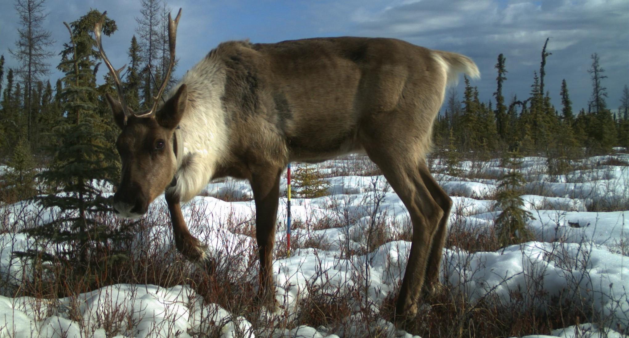
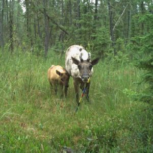
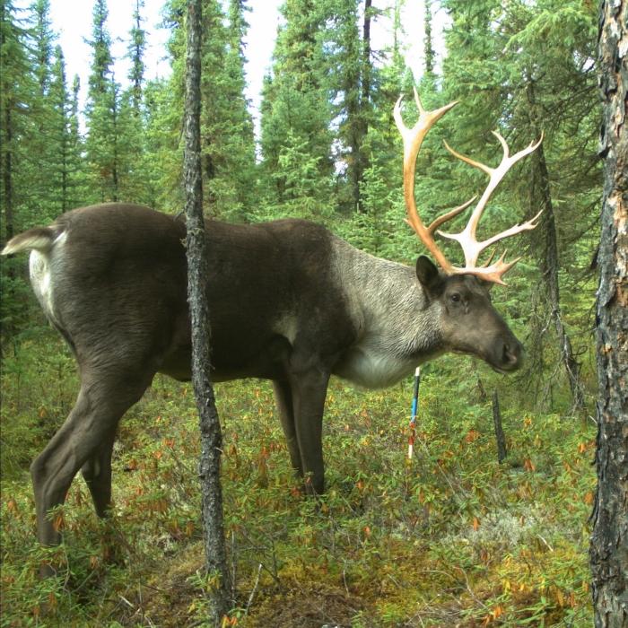
Mapping Vegetation Regeneration to Support Caribou Habitat Recovery
Using vegetation regeneration mapping to assess Woodland Caribou habitat status.
.svg)
This section highlights ongoing work that uses lidar and machine learning to map vegetation regrowth on legacy and low-impact seismic lines. The resulting data provide a way to monitor disturbance recovery and support restoration efforts in caribou ranges.
Introduction
- Six caribou ranges overlap the Al-Pac FMA area. Of these six caribou ranges, two are increasing, three are stable, and one is declining as of 2022[1].
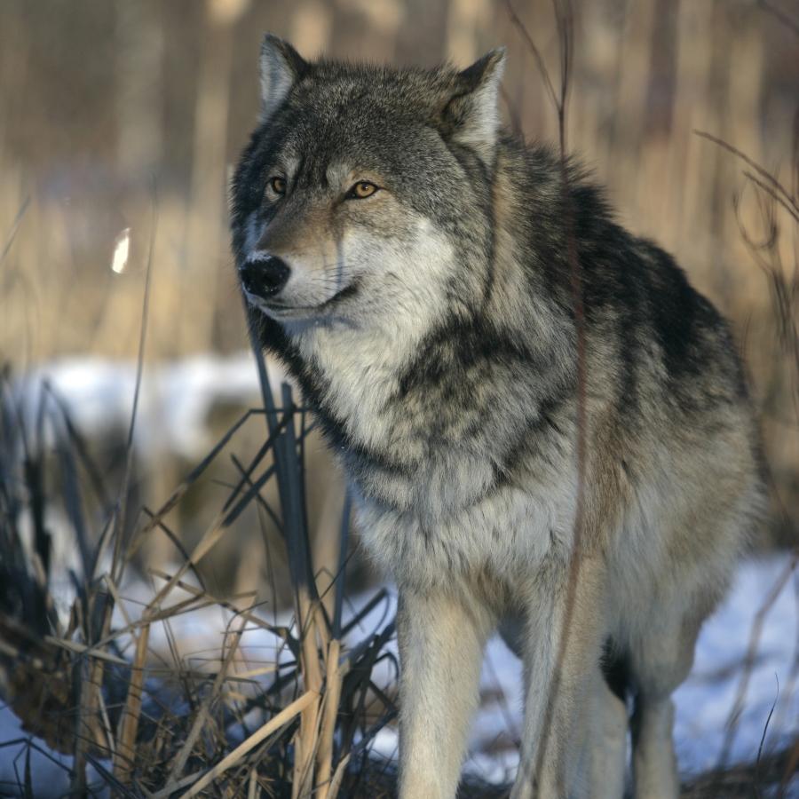
- Restoring habitat is central to boreal Woodland Caribou population recovery, with a major focus on legacy seismic lines. These lines increase wolf hunting efficiency and predation pressure by providing easier access to caribou habitat.
- As part of sub-regional planning and stewardship, restoration treatments of approximately 5,000 km of lines are planned in Woodland Caribou ranges, including nearly 2,000 km within or overlapping the Al-Pac FMA area, as of 2024[2].
- Monitoring the success of restoration treatments of legacy seismic lines is essential to support the recovery of boreal Woodland Caribou habitat. Evaluating vegetation on these linear features using technology such as lidar, a type of remote sensing, shows strong potential, but reliable methods still need to be developed and tested.
At Issue
- Human footprint from industrial activity (e.g., forest harvesting) converts old forests into early seral stands that support higher densities of moose and deer—the main prey of wolves. At the same time, milder winters from climate change contribute to these increases. The resulting rise in prey populations boosts wolf numbers, leading to unsustainable levels of incidental predation on caribou[5,6,7,8].
- Linear features such as seismic lines, pipelines, and roads further amplify these effects by increasing wolf hunting efficiency as they move more quickly and over greater distances[9], while also providing access into caribou habitat, which in turn contributes to higher wolf densities[10].
The combined effect of these factors has altered predator-prey dynamics in caribou ranges, leading to higher caribou mortality and population declines.
Younger forests mean more moose and deer—and more wolves...
...while linear features give wolves easier travel routes for hunting...

...leading to higher caribou mortality.
Caribou Habitat Recovery in Alberta
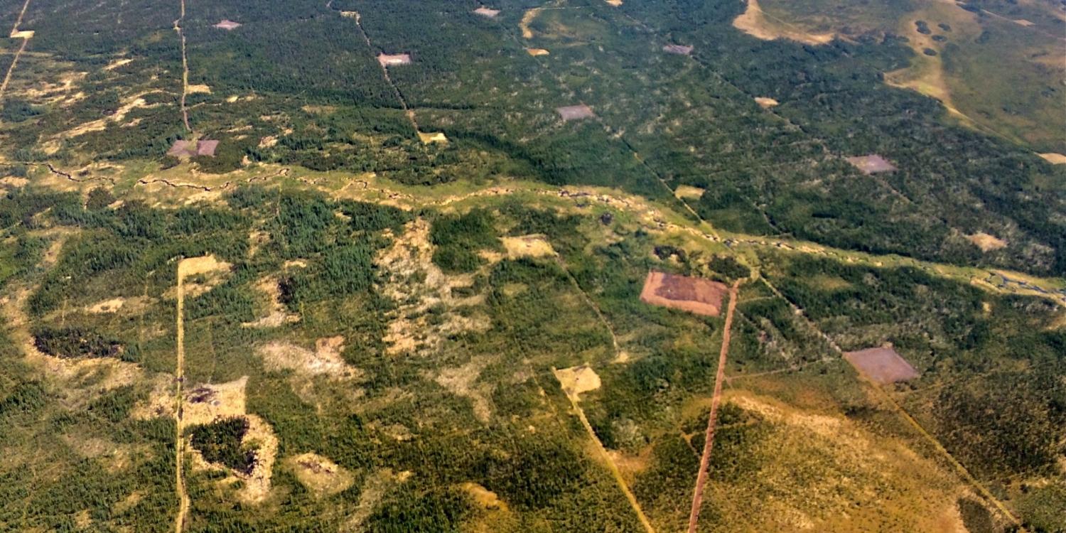
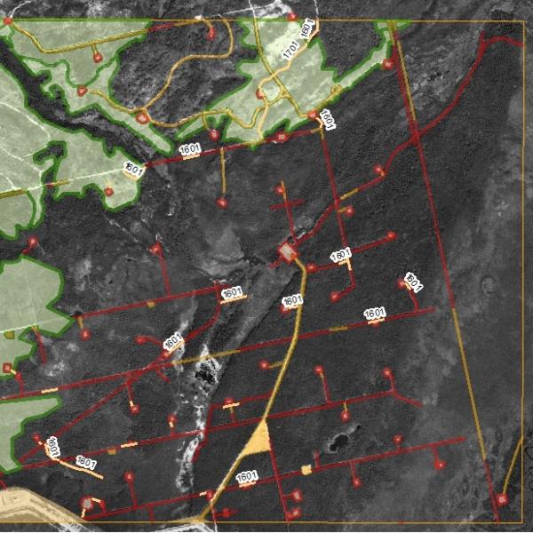
Caribou Ranges in the Al-Pac FMA area. Six caribou ranges overlap the Al-Pac FMA area. Conventional seismic are shown as of 2023. Click on the layers in the legend to turn on and off. Zoom in on the map for a detailed view of the distribution of conventional seismic and caribou ranges.
- One goal of sub-regional planning is to enable caribou habitat to recover towards at least 65% undisturbed habitat within 50–100 years, ensuring caribou have the habitat needed for survival and recovery[11].
- Alberta is developing a framework to monitor and report on boreal Woodland Caribou habitat disturbance and recovery. It will measure undisturbed habitat and track the effects of wildfire and human activity, such as logging and industrial development, within each local caribou range[2].
- As part of boreal Woodland Caribou habitat recovery efforts, about 5,000 km of legacy seismic lines have been targeted for restoration activities including 1,905 km in caribou ranges within or overlapping the Al-Pac FMA area—800 km in Cold Lake, 530 km in East Side Athabasca River, and 575 km in Red Earth. So far, 138 km have been treated in the Cold Lake range[2].
- The Regional Industry Caribou Collaboration—a group of energy and forestry companies working in northeastern Alberta—has assessed or treated over 2,300 km of seismic lines within boreal Woodland Caribou ranges. Of these, 518 km are naturally regenerating and 1,798 km have been actively treated or planted[12].
Project Highlights
To evaluate how well seismic lines are recovering, the program focuses on two key indicators:
- Functional Recovery: This measures whether vegetation has grown tall enough to slow wolf movement and reduce predation risk for caribou. Wolves travel quickly along open seismic lines but slow down once vegetation exceeds 50 cm in height. When vegetation grows taller than 4 m, wolf movement drops to levels similar to those in undisturbed forest, and human use of these features also declines.
- Return to Forest Cover: Under this indicator, lines are considered as regenerated when vegetation height reaches at least 70% of the height of nearby forest and has similar plant species.
These vegetation indicators are measured using new, highly accurate mapping methods that better detect linear disturbances—particularly narrow features such as low-impact seismic lines and trails beneath dense canopy—that were previously missed by manual mapping.
This multi-year program is building tools to monitor and track habitat recovery and support future conservation and restoration decisions in caribou habitat. These tools include the Caribou Habitat Information Platform, which reports on the current status and trends of undisturbed and disturbed areas in caribou ranges, and the Range Disturbance and Recovery Tool, a web app for exploring disturbance data in caribou ranges, both available through the Caribou Habitat Tracker online report (coming soon!)
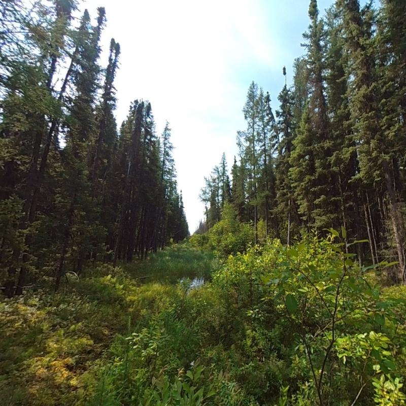

Linear features, including legacy and low-impact seismic lines, are widespread across Alberta’s landscape.
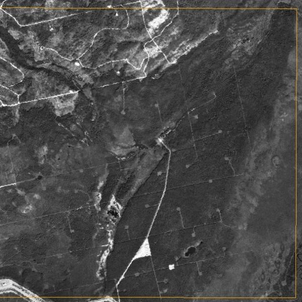
Airborne data and machine learning are used to map these linear disturbances.
New mapping methods more accurately detect narrow linear disturbances previously missed by manual mapping.
References
Environment and Climate Change Canada. 2024. Report on the Progress of the Recovery Strategy Implementation (Period 2017 - 2022) and the Action Plan Implementation (Period 2018 - 2023) for Caribou (Rangifer tarandus), Boreal Population, in Canada. Species at Risk Act Recovery Strategy Report Series. Environment and Climate Change Canada, Ottawa. Xii + 125 pp. Available at: https://www.canada.ca/en/environment-climate-change/services/species-risk-public-registry/report-progress-recovery-document/caribou-rangifer-tarandus-boreal-report-progress-recovery-strategy-2017-2022-action-plan-2018-2023.html
Alberta Environment and Parks. 2024. First Report on the Implementation of the Section 11 Agreement for the Conservation and Recovery of the Woodland Caribou in Alberta. Government of Alberta. Available at: https://open.alberta.ca/publications/first-report-implementation-section-11-agreement-conservation-recovery-woodland-caribou-in-alberta/resource/d97ae4cf-71fa-4f46-9b28-cbb295e20944.
COSEWIC. 2002. COSEWIC Assessment and Update Status Report on the Woodland Caribou Rangifer Tarandus Caribou in Canada. Ottawa: Committee on the Status of Endangered Wildlife in Canada. Available at: https://www.canada.ca/en/environment-climate-change/services/species-risk-public-registry/cosewic-assessments-status-reports/woodland-caribou.html.
Alberta Sustainable Resource Development and Alberta Conservation Association. 2010. Status of the Woodland Caribou (Rangifer Tarandus Caribou) in Alberta: Update 2010. Edmonton, AB: Alberta Sustainable Resource Development.
Bergerud, A.T., J.P. Elliot. 1986. Dynamics of Caribou and Wolves in Northern British Columbia. Canadian Journal of Zoology 64(7): 1515–29. Available at: https://cdnsciencepub.com/doi/10.1139/z86-226.
James, A.R.C., S. Boutin, D.M. Hebert, A.B. Rippin. 2004. Spatial Separation of Caribou from Moose and Its Relation to Predation by Wolves. Journal of Wildlife Management 68(4): 799–809. Available at: https://doi.org/10.2193/0022-541X(2004)068[0799:SSOCFM]2.0.CO;2.
Latham, A.D.M., M.C. Latham, N.A. Mccutchen, S. Boutin. 2011. Invading White-Tailed Deer Change Wolf–Caribou Dynamics in Northeastern Alberta. The Journal of Wildlife Management 75(1): 204–12. Available at: https://onlinelibrary.wiley.com/doi/abs/10.1002/jwmg.28.
Dickie, M., R. Serrouya, M. Becker, C. DeMars, M.J. Noonan, R. Steenweg, S. Boutin, A.T. Ford. 2024. Habitat Alteration or Climate: What Drives the Densities of an Invading Ungulate? Global Change Biology 30(4): e17286. Available at: https://onlinelibrary.wiley.com/doi/abs/10.1111/gcb.17286.
Dickie, M., R. Serrouya, R.S. McNay, S. Boutin. 2017. Faster and Farther: Wolf Movement on Linear Features and Implications for Hunting Behaviour. Journal of Applied Ecology 54(1): 253–63. Available at: https://onlinelibrary.wiley.com/doi/abs/10.1111/1365-2664.12732.
DeMars, C.A., S. Boutin. 2018. Nowhere to Hide: Effects of Linear Features on Predator–Prey Dynamics in a Large Mammal System. Journal of Animal Ecology 87(1): 274–84. Available at: https://onlinelibrary.wiley.com/doi/abs/10.1111/1365-2656.12760.
Environment and Parks. 2022. Cold Lake Sub-Regional Plan. Government of Alberta. Available at: https://open.alberta.ca/publications/cold-lake-sub-regional-plan#summary.
Regional Industry Caribou Collaboration. 2021. RICC 2021 Annual Report. Available at: https://wildlifescience.ca/resource/ricc-2021-annual-report/.
