Reporting Area and Landscape Context
Overview of the Al-Pac FMA area highlighting Indigenous lands, dominant ecosystems, wetland types, and wildfire history.
.svg)
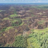
Fire is the dominant natural disturbance, burning 13% of the Al-Pac FMA area in the past five years.
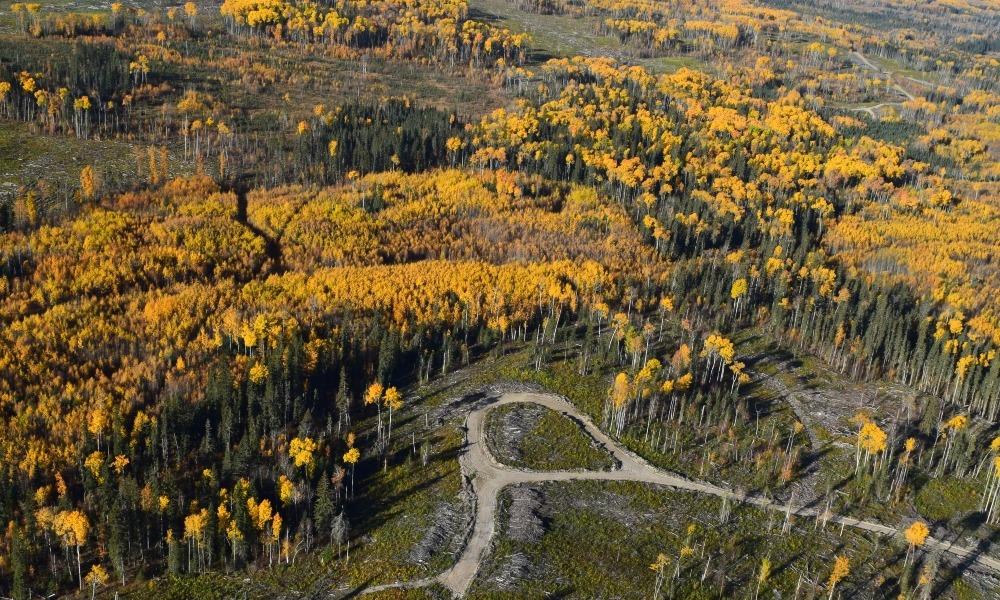
Central mixedwood is the dominant ecosystem type, covering 73% of the land base.
Wetlands cover 43% of the land base, with fens being the most common.
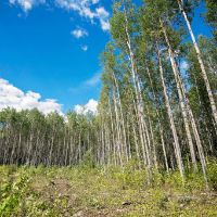
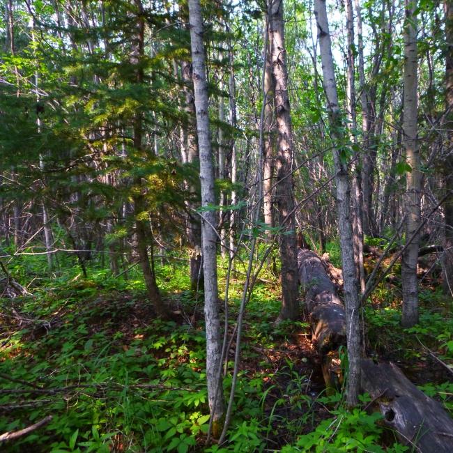
Forest harvest occurs primarily in upland forests including Trembling Aspen, White Spruce, and Jack Pine.
Introduction
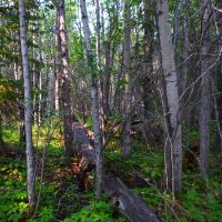
- Boreal mixedwood forest, containing deciduous and coniferous species that provide habitat for a diverse array of plants and animals.
- Approximately 2.1 million hectares (21,000 km2) of harvestable forest landscape, along with about 4.4 million hectares (44,000 km2) of wetlands, non-commercial black spruce stands and non-harvestable forest areas (e.g., river valleys, slopes, and riparian areas).
- Large areas leased for oil and gas development and associated infrastructure, such as roads, pipelines, and industrial facilities.
- A natural disturbance regime that is dominated by wildfire, with insects and disease also playing important roles.
- Socially and economically valued activities including hunting, fishing, trapping, and other recreational pursuits.
Landscape Context
About the Al-Pac FMA Area
- A Forest Management Agreement (FMA) area is an area-based tenure agreement that gives a forestry company the right to establish, grow and harvest timber. This FMA area is the largest in Alberta, covering about 10% of the province.
- The Al-Pac FMA area boundary has remained largely unchanged since the most recent reporting by the ABMI in this region in 2020.
- The FMA boundary was modified in 2011 due to the Treaty Land Entitlement settlement between Canada, Alberta, and Bigstone Cree Nation, and the creation of new conservation areas associated with the Lower Athabasca Regional Plan.
- Al-Pac primarily harvests deciduous trees (Trembling Aspen, Balsam Poplar) in its FMA area, but in some Forest Management Units also has tenure over coniferous trees. In most of the FMA area, timber quotas for coniferous trees are held by eight other forestry companies[1].
- Note that several parcels of land within the broader FMA boundary are not part of the FMA area itself and are therefore excluded from the analysis. These parcels include a range of land uses with highly variable disturbance levels, such as Provincial Parks, First Nations reserve lands, and active oil sands mining projects. This report focuses solely on the FMA area to provide a clear understanding of biodiversity and land cover trends within the area managed under Al-Pac’s forest management system.
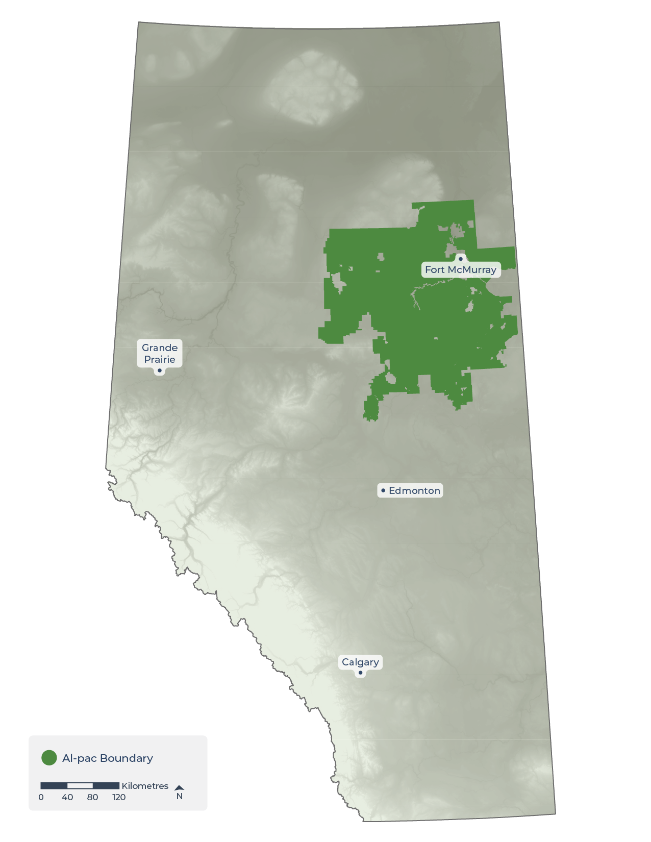

Area of Analysis. Location of the Al-Pac FMA area in Alberta highlighted in green.
Indigenous communities located within the FMA's boundary include[2]:
- Bigstone Cree Nation
- Chipewyan Prairie First Nation
- Fort McKay First Nation
- Fort McMurray First Nation
- Heart Lake First Nation
- Peerless Trout First Nation
- Ft. McKay Métis Nation
Indigenous Lands. Overlap of the Al-Pac FMA area with Treaty 6 and 8 Territories and Indigenous Communities within the FMA area.
- The Boreal Forest Natural Region consists of the following natural subregions in the FMA area: Central Mixedwood (73.3%), Lower Boreal Highlands (19.4%), Upper Boreal Highlands (4.0%), and Athabasca Plain (2.6%).
- The Central Mixedwood Natural Subregion is relatively well-protected across Alberta, with 22.7% in protected areas, while the Lower and Upper Boreal Highlands natural subregions have much lower protection levels—5.6% and 3.0%, respectively—highlighting the importance of careful management in these areas.
- The portion of the Foothills Natural Region within the Al-Pac FMA area is classified as the Lower Foothills Natural Subregion, covering 0.7% of the total FMA area.
- The FMA area is managed for multiple values, including resource extraction (such as forestry, oil & gas, aggregates, and peat), recreation, and biodiversity.
- However, there are large, protected areas located outside its boundaries—particularly to the north and east—that can serve as ecological benchmarks for comparison with the working forest land base within the FMA area itself.
Ecosystem Types. Distribution of natural regions and natural subregions that overlap with Al-Pac's FMA area.
Central mixedwood is the dominant ecosystem type.
| Al-Pac FMA Area | Alberta | |||
|---|---|---|---|---|
| Natural Region | Natural Subregion | Area (km2) | Area (%) | Managed as Protected Area (%) |
| Boreal Forest | Athabasca Plain | 1,651 | 2.6 | 4.4 |
| Central Mixedwood | 46,672 | 73.3 | 22.7 | |
| Lower Boreal Highlands | 12,373 | 19.4 | 5.6 | |
| Upper Boreal Highlands | 2,563 | 4.0 | 3.0 | |
| Foothills | Lower Foothills | 455 | 0.7 | 0.3 |
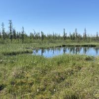
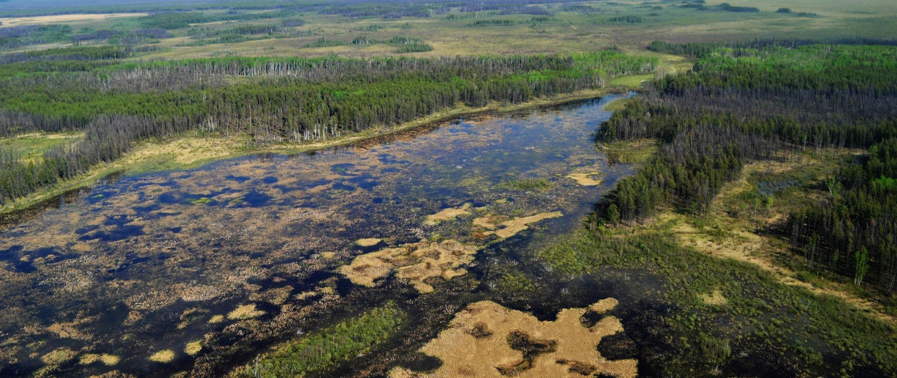
- Wetlands can purify water, reduce flooding and drought, store carbon, recycle nutrients, support plant growth, and provide critical habitat for wildlife. They also enhance biodiversity by creating a variety of habitats that support many species.
- Wetlands are common in the Al-Pac FMA area, covering 43.3% of the land base.
- Fen (also known as muskeg) is the most common wetland class, covering 28.9% of the Al-Pac FMA area, followed by swamp (6.5%), bog (4.7%), and open water (2.6%). Marshes cover <1.0% of the area.
- Many wetlands in the Al-Pac FMA area have been recognized federally or provincially as ecologically significant because they provide important habitat for Trumpeter Swans (a species of special concern in Alberta), colonial nesting birds, and in some cases overlap with designated Important Bird Areas, particularly in the western and southern parts of the region.
Wetland Types. Distribution of wetlands, by class, in the Al-Pac FMA area.
| Wetland Class | Area (km2) | Area (%) |
|---|---|---|
| Bog | 2,994 | 4.7 |
| Fen | 18,413 | 28.9 |
| Marsh | 382 | 0.6 |
| Open water | 1,657 | 2.6 |
| Swamp | 4,141 | 6.5 |
| All Wetlands Combined | 27,587 | 43.3 |
- Fires recycle nutrients, create diverse habitats, and maintain a mosaic of forest ages.
- However, recent fire seasons have become larger and more intense, reducing timber supply, threatening communities, disrupting land use, and altering habitats in ways that may significantly change biodiversity.
- 44.1%, or 28,090 km2 of the Al-Pac FMA area has burned since 1925, with some areas burning more than once.
- Nearly equal amounts of disturbance from wildfire have occurred in the past 20 years (2005-2024; 15.4%) compared to the previous 40 years (1965 to 2004; 16.4%).
- The different effects of recent fires on the land base and biodiversity are examined in sections 3.2 and 4.3.
Fire History. Distribution of wildfires in the Al-Pac FMA area from 1925 to 2024.
| Time Period | Area Burned (km2) | Area Burned (%) |
|---|---|---|
| 2020–2024 | 1,708 | 2.7 |
| 2015–2019 | 5,831 | 9.2 |
| 2005–2014 | 2,303 | 3.6 |
| 1965–2004 | 10,471 | 16.4 |
| 1925–1964 | 7,777 | 12.2 |
| Total | 28,090 | 44.1 |
References
Alberta-Pacific Forest Industries Inc. 2022. Alberta-Pacific Forest Products Inc. Forest Management Agreement Area Forest Stewardship Report. Alberta-Pacific Forest Industries Inc. Available at: https://alpac.ca/wp-content/uploads/2021/06/Al-Pac-Stewardship-Report-2015-2020_complete_NCedit_21May21_final.pdf.
Habib, T., K. Stewart-Shepherd, T. Langille-Hayward, T. Clark, K. McCleary. 2025. High Conservation Values in the Alberta-Pacific Forest Industries Inc. Forest Management Agreement Area. Available at: https://alpac.ca/wp-content/uploads/2025/11/Al-Pac-2025-HCV-Reassessment-Report-October-2025.pdf.
